What, Why and When? Research Design and History of Kinneret Regional ressroject Excavations on Horvat Kur
For many years, archaeological explorations on Tel Kinrot have concentrated on a sequence of mostly urban settlements from the Neolithic through the Bronze Age to the Iron Age-I and Iron Age-II periods. When the excavation of the large domestic unit in Field I on the Tel had been completed in 2008, KRP decided to temporarily suspend fieldwork on the Tel and concentrate on preparing finds and findings for publication. KRP also decided to use this opportunity to expand its archaeological scope in terms of place, periods and research questions by examining a rural Galilean site from the Hellenistic to Byzantine periods (ca. 1st c. BCE to 7th c. CE). With that new focus, KRP wants to contribute to the ongoing discussion on living conditions in and cultural influences on a region that formed the spacial context for the Jesus movement and earliest Palestinian Christianity, as well as for local Jewish communities during the Roman and Byzantine periods . KRP especially aimed at answering these research questions:
- how an average rural settlement from the Hellenistic to Byzantine period functioned;
- how such a settlement interrelated to human-made or natural transformations of the surrounding landscape;
- how that village relates to the wider Mediterranean context (characteristics, interactions).
Testing the Ground on Horvat Kur
Just like much other archaeological work, KRP’s new activity started above ground – on the desk and in the library. Before a small team even went out to the field and started a surface survey in 2007, team members ploughed information from old maps (especially a map by Gottlieb Schumacher dated to 1889), previous survey literature and regional experts to find a site suitable to help us answer our research questuions. All indicated that Horvat Kur, a site located in the hills just west of Tel Kinrot, in the midst of fertile plains on a high-plateau above Wadi Amud, might be a good candidate to answer these questions.
The initial survey conducted in July 2007 parallel to the penultimate excavation campaign on Tel Kinrot so far revealed that Horvat Kur had indeed densely been built up with terraces and houses during the Roman and Byzantine periods. Some earlier and later shards indicated that settlement extended beyond these peak periods, a late Ottoman farmstead on the western slope of the hill is the only later structure discovered so far. A possible public building (tentatively identified as a synagogue in older literature) on top of the hill suggested that the settlement had some architectural and social differentiation .
Going Below Ground
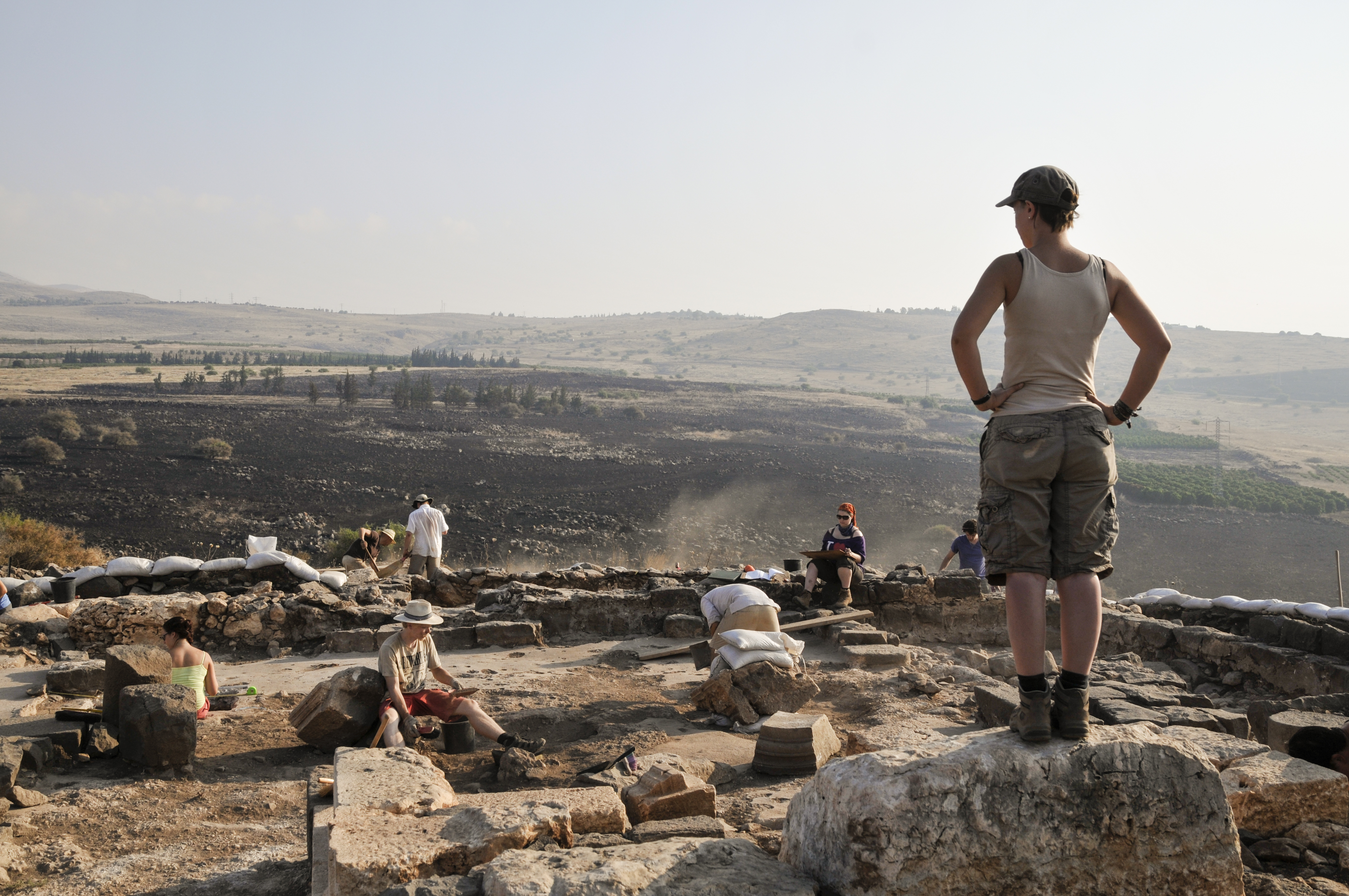
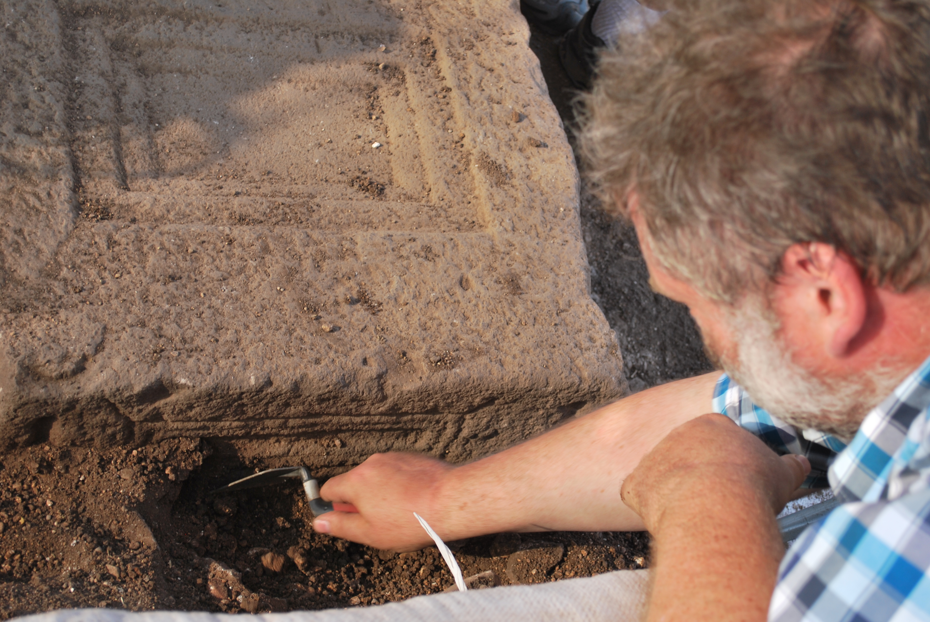
A test excavation was launched in 2008 to check if the surface finds are matched by sufficient sub-surface evidence to justify systematic archaeological work on Horvat Kur in the future. Two 6 x 3 m trenches were dug, one on the northeastern edge of the plateau (Area A) and another one 40 m to the north on a lower building terrace (Area B). They produced very mixed result: while we almost immediately reached bedrock in Area B, Area A proved more prolific. Here, two parallel walls, pottery, glass, coins, many roof tiles and enough sediment were found to allow us assigning the remains to the Late Roman and Early Byzantine periods. In addition, a systematic survey in the vicinity showed that the region was intensively settled and used for agriculture in the periods contemporaneous to the main habitation on Horvat Kur. A study season was scheduled in 2009 to analyze these finds, fine-tune the research design and devise a strategy for future systematic explorations .
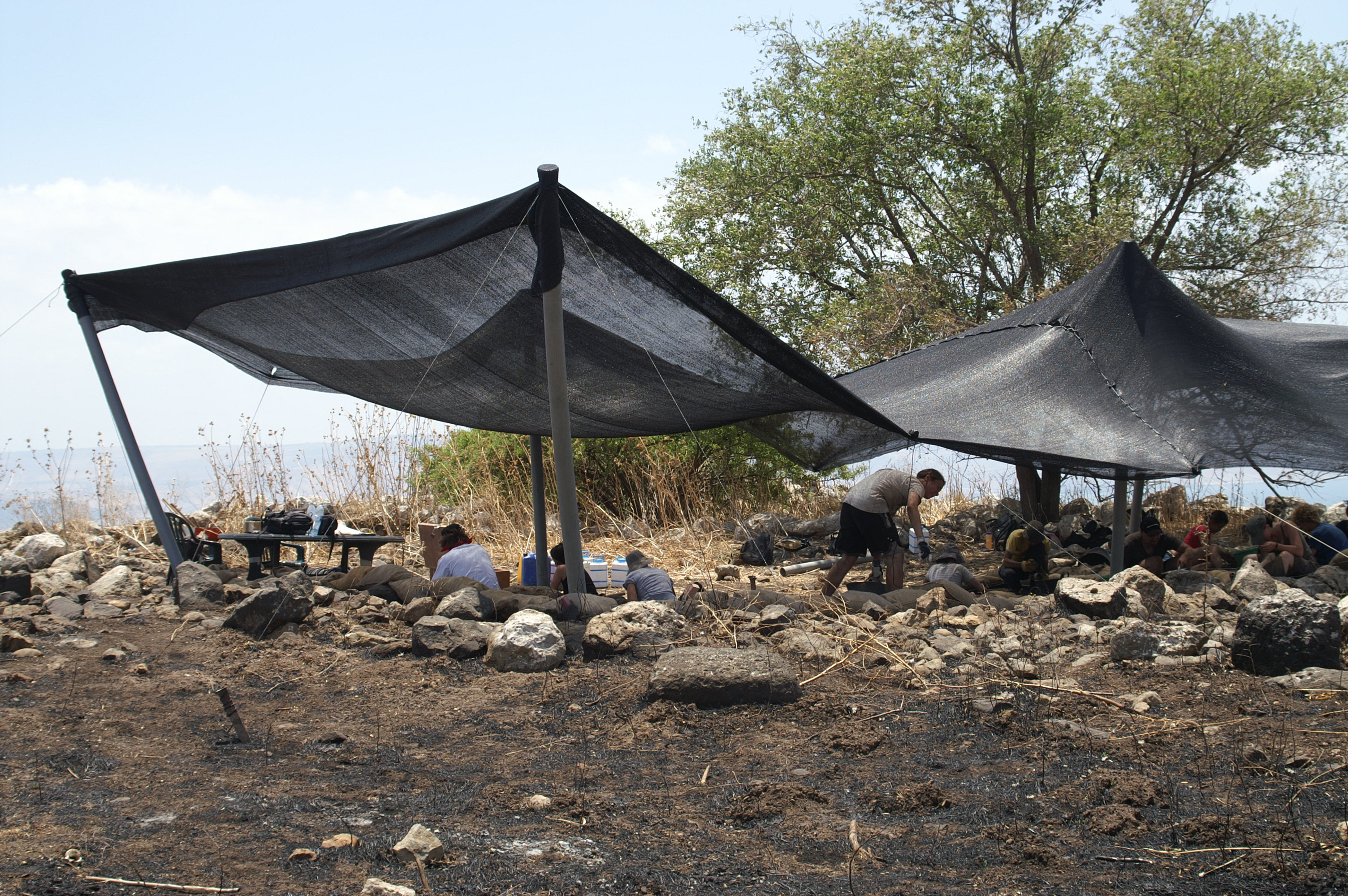
Area C during the 2010 season (photographed by L. Petit; © Kinneret Regional Project).
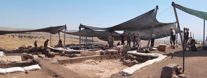
2010 – The First Full Season: A Synagogue and Domestic Units
The first full fieldwork season was conducted in 2010 by a team sponsored by the University of Bern (Stefan Münger), the University of Helsinki (Raimo Hakola) and Leiden University (Jürgen K. Zangenberg). Excavations continued in Area A and followed the two parallel walls found in 2008. Here, it soon became evident that the parallel walls and rich finds encountered in 2008 and 2010 belonged to a Byzantine period synagogue, but of a very different kind and layout than it had been suggested in previous literature.
In addition to Area A, KRP also opened a new Area C in 2010 to pursue the original research design and examine domestic structures. In Area C, the excavators soon discovered remains of two domestic units each dating to two phases of the Byzantine period. From Unit I a section of the courtyard with installations, a pavement and a line of three interior rooms of the adjacent house were found, from Unit II just south of Unit I only the entrance area. Both units were separated by a narrow alley. Preliminary ceramic readings suggest that Area A and C complement each other very well in terms of chronology and function.
Thanks to the excellent aerial pictures shot by Skyview Ltd. and a bush fire just before the season we were able to correct our initial assumption about the size of the settlement of ca. 1.5 ha to an estimated size of ca. 3 ha. We do not know, however, if the entire 3 ha were occupied at the same time, since we still lack sufficient data to describe the growth of the settlement expansion in detail .
The synogogue in Area A during the 2013 season (photographed by B. de Groot; © Kinneret Regional Project).
2011 – 2014 Concentrating on the Synagogue
The subsequent seasons 2011 through 2014 (since 2012 reinforced by our new, fourth partner Wofford College and Byron McCane) entirely focussed on the synagogue in Area A. The discovery of a new synagogue was not planned in our original research design, but almost immediately developed its own dynamic – certainly in a period of intense academic discussion on the archaeology and chronology of Roman and Byzantine synagogues in the Land of Israel. What could Horvat Kur contribute to the debate? In any case, KRP decided to postpone excavations in domestic Area C until the synagogue in A will be fully excavated and published.
Data from the 2010 season seemed to indicate that the synagogue at Horvat Kur, like so many other contemporaneous Galilean synagogues, followed the longhouse type, apparently measuring only 11 m north-south by 7 m east-west. But after the 2011 season it was clear that the building was much bigger, belonged to the broad house type, measured no less than 11 m north-south, about 16.5 m east-west and had a portico along its western side. Quite a difference!
Preliminary analysis of architecture and associated ceramics and coins during the 2014 study season indicate that the synagogue at Horvat Kur had 5 phases. After a pre-synagogue occupation (pre-synagogue Phase 1), the first synagogue was built around 420 CE (Phase 2). After severe damage probably caused by an earthquake, the synagogue was rebuilt on the earlier basis and using much earlier architectural material (Phase 3). During this second main phase, dating to the late 6th c. CE, a portico was added west of the western wall (possibly also using an earlier structure), benches were built along the interior faces of the walls and the large bemah attached to the southern wall. Very shortly after 600 CE the building was overhauled and more low benches were inserted between the columns to increase seating capacity (Phase 4). The synagogue apparently went out of use and was abandoned sometimes in the second half of the 7th c. CE. There are indications that the area was also used late by very low-scale habitation, but this is very difficult to date (post-synagogue Phase 5). Only very few remains in unsealed fills close to topsoil securely date to the Umayyad period.
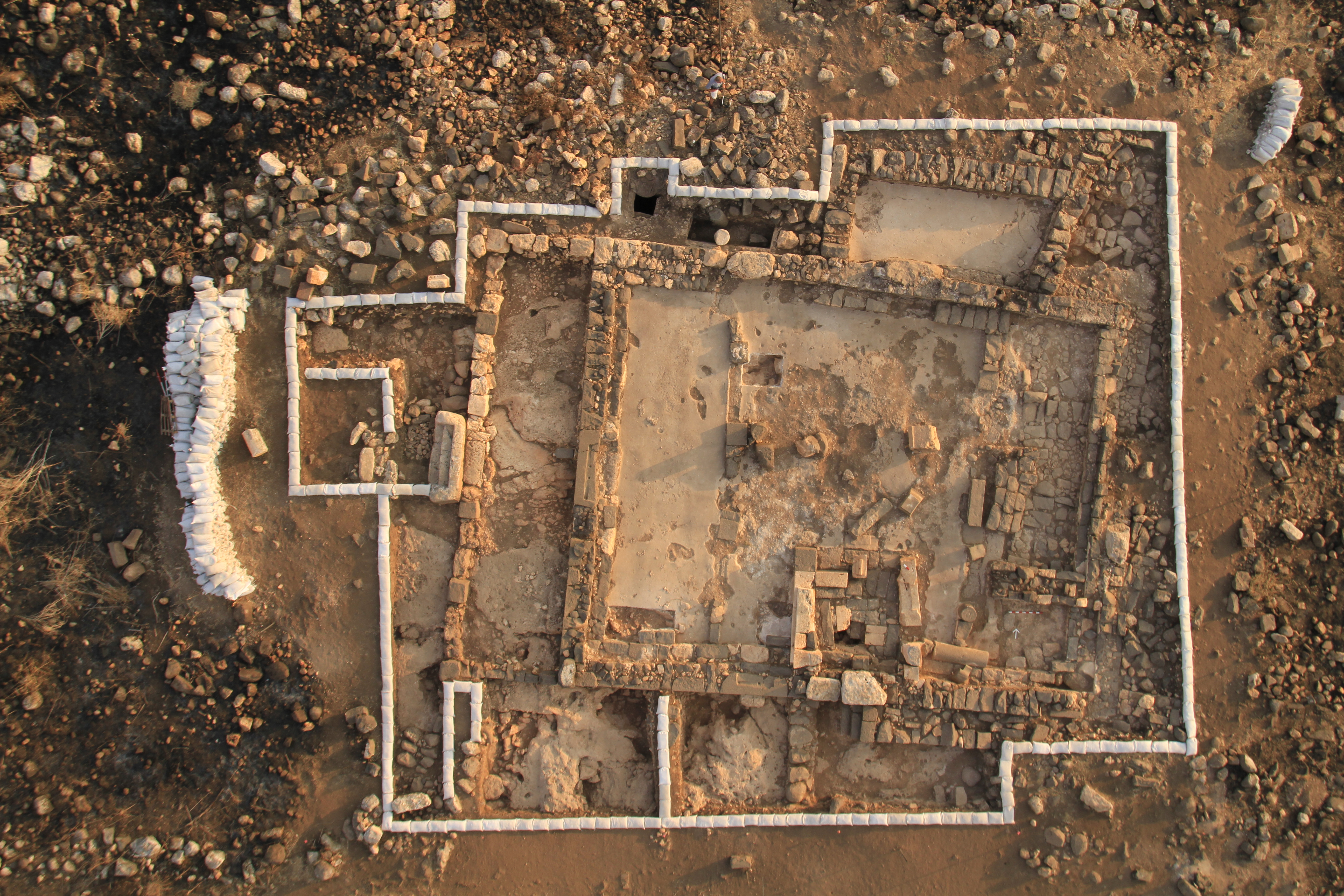
Every season since 2011 until the final excavation in 2014 revealed more details of the synagogue’s architecture and interior. The synagogue was mainly built of basalt blocks, set in two rows, the outer face worked and the inner filled with smaller unhewn stones. Two doors have been found. In the center of the western wall, a double-winged entrance served as the ‘main’ access into the building from the village. A second, narrower entrance with a single stepping stone outside and three steps inside opened to the south. Its position was not entirely in the centre, but slightly shifted to the west to make room for the bemah.
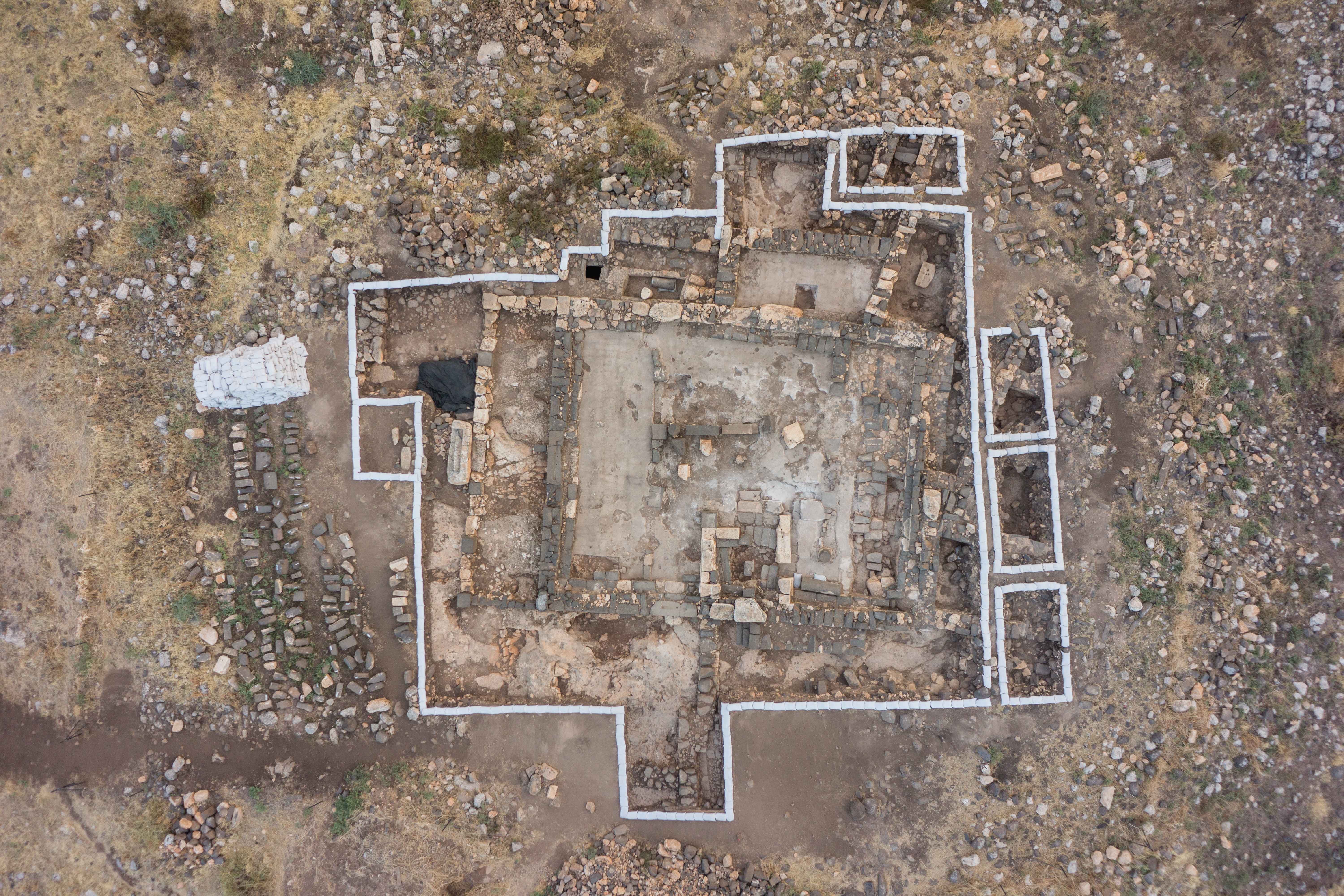
Aearial view of the synogogue in Horvat Kur at the end of the 2013 season (photographed by P. Partouche; © www.skyview.co.il).
Let us now turn to the interior of the synagogue. Here, a bench ran along the inner side of the walls. Evidence for such a bench has been found in 2010 and 2011 on the northern, western and southern sides, excavations in 2012 showed that the bench also continued in the east, even in two phases. Two rows of 4 column bases running north-south (some robbed out) suggest that the interior of the synagogue had a basilical layout with an aisle-nave-aisle order for the synagogue. During the second synagogue phase, the spaces between the columns were filled by a lower bench partly built of earlier architectural elements that now increased the available seating space.
More than 50.000 tesserae in fills mostly to the west of the building indicate that the synagogue was once adorned with a mosaic. In 2013, a small patch of mosaic with a fragmented geometric pattern was found close to the southern wall. Apparently, the mosaic belonged to the first synagogue phase and had been removed in the second phase and replaced by a simple floor made of grey plaster.
Probably the most interesting internal structure are the foundations of a square podium abutting the southern wall just to the east of the southern entrance (bemah). There can be no doubt that this structure once served to support a superstructure for housing the Torah shrine (aron). Unlike the rest of the synagogue, the bemah is constructed of high-quality, very carefully dressed limestones. The bemah must have nicely been adorned, which is demonstrated by fragments of a lion relief, a wreath and a couple of decorated architectural elements. Due to heavy robbing, the exact form of the bemah must unfortunately remain hypothetical. From what was found, though, it seems likely that the Horvat Kur bemah resembled its much better preserved “cousin” at Umm el-Qanatir.
Of great importance, furthermore, is a plain limestone seat with two steps leading up to it, found in situ atop the bench on the southern wall just to the west of the southern entrance. Bench, stone seat, entrance and bemah clearly constitute a purposeful arrangement and underline the prime liturgical significance of the southern wall. This seat was probably used by the leader of the congregation during its gatherings. It is the first such seat ever found in situ in the north of Israel.
The basalt stone being unearthed during the 2012 season (photographed by B. de Groot; © Kinneret Regional Project).
Certainly the most spectacular object unearthed in the excavations was a basalt stone, shaped like a low table and decorated with figurative elements on one side and geometric patterns on the other three sides. The Horvat Kur stone resembles a similar piece discovered a few years ago at nearby Migdal. The Horvat Kur stone, however, is made of different material (basalt), and was found in a secondary, 6th c. AD context, i.e. integrated into the eastern low bench mentioned above. There is no reason, therefore, to simply interpret the Horvat Kur stone as a “second Magdala table”. Its form and function are currently being studied, a publication is in preparation .
Palynological Research
Since 2011, excavations are accompanied by palynological (pollen) analysis of samples taken from plasters within the synagogue. These plasters contain pollen which might have stuck to it when it was still wet during construction. Pollen and spores can give an excellent picture of past vegetation, e.g. the ratio of wooded landscapes to open grasslands. Based on pollen data, it is possible to reconstruct ancient vegetation and even climatic fluctuations as well as periods of enhanced human impact. Pollen diagrams from nearby Lake of Galilee indicate intense agricultural activity during the Roman and Byzantine periods, shown by exceptionally high percentages of olive-, walnut-, grape- or carob tree percentages including a strong appearance of weeds. However, the Lake is a large pollen trap reflecting regional vegetation fluctuation whereas the pollen caught in local plaster like from Horvat Kur is of local origin and might provide insight into conditions of the micro-region in the vicinity of the synagogue. With the help of the Deutsche Palästina-Verein analysis is in progress, several samples show moderately preserved pollen in satisfying concentrations. The study is supported by pollen data from modern surface samples at the site, clearly reflecting an open, semi-arid Mediterranean landscape .
Finalizing the Synagogue
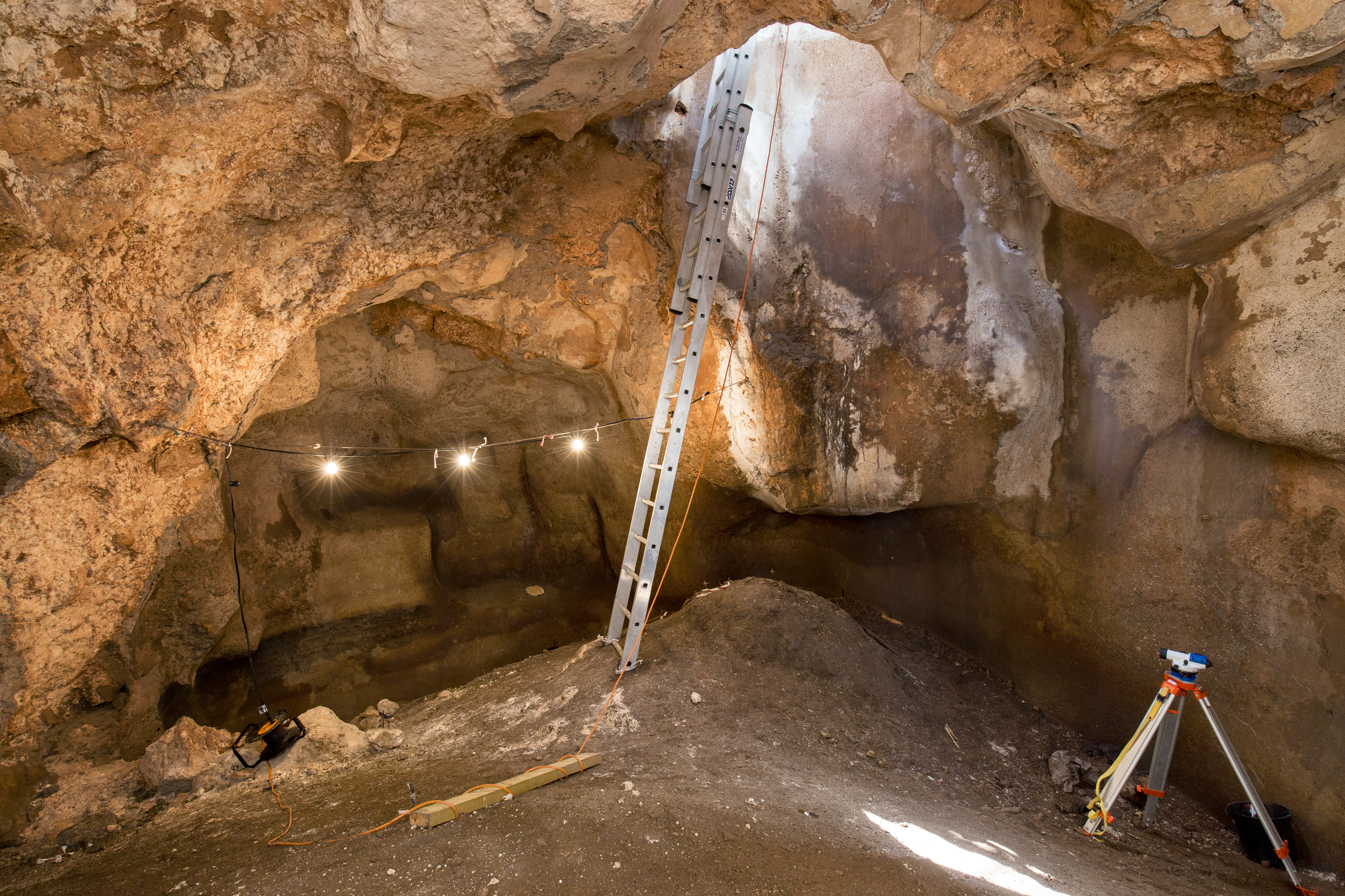
Work in the cistern at the northern end of the synagogue during the 2016 season (photographed by J. Haapanen; © Kinneret Regional Project).
The end of the 2013 season saw the synagogue fully exposed, ready to be carefully analyzed and interpreted in all its material and historical aspects. The process of reflection was begun during a very inspiring 2014 study season. During the discussions, it became apparent that a last, final excavation season would be necessary to securely establish the stratigraphy by cleaning up several features inside the synagogue and by fully excavating the collapse just outside the northeastern synagogue corner and along the northern and eastern syangogue walls.
What originally sounded like a mere mopping up activity quickly developed its very own dynamics and agenda. The squares opened in the northeast and east took us right into the village (rooms, courtyards) that apparently covered the slopes directly adjacent the synagogue. The northeastern corner of the synagogue apparently sits on a much older terrace wall. Two well preserved destruction layers not only helped us date the two phases of the 5th to 7th c. CE “basilical broadhouse synagogue”, but also produced many rooftile fragments that are now being analyzed for provenience and composition. To the west of the corner, several rooms divided by a narrow, stepped alleyway were discovered. Even further west, one of the water catchment pools discovered in 2012 was fully excavated to understand its size and function, Along the eastern wall, parts of even more domestic units were excavated down to bedrock, demonstrating how closely connected the synagogue was with the village on these two sides. Evidence from the 2016 excavations complemented this picture by checking the areas to the west and south of the syangogue: here, where two entrances gave access to the synagogue, the village was separated from the community building by a piazza-like space about 5-7 meters wide.
The discovery of the eastern end of the stepped ramp attached to the southern wall demonstrated that this structure did not lead up to a neighbouring house but apparently gave access to a door higher up on the southern synagogue wall which might have led to an interior balcony.
Inside the synagogue, things took a very unexpected turn when a late, intrusive wall was removed and the area east of the limestone platform (bemah) was cleaned. Here, a small line of mosaic stones (tesserae) had already been located under a thick layer of floor plaster at the end of the 2013 season, but had been left unexcavated for lack of time. When rechecked in 2015, it quickly became clear that the preserved mosaic piece was larger than expected and certainly not “plain white” as originally assumed. The nearly 100.000, mostly single tesserae found so far in different fills now seem to be complemented with at least a stretch of mosaic in situ. Since no KRP team member has any experience in excavating and preserving a mosaic, a real expert was called in: Orna Cohen. During a full week of meticulous work she was able to fully expose the mosaic fragment. It showed an Aramaic inscription (“El’azar, Son of Yudan, Son of Susu”), the upper parts of a menorah and several decorative panels from which mostly only very small fragments have survived . Apart from several iconographic and social aspects currently under examination, the mosaic’s stratigraphic implications are especially important: Since a pillar base connected to the construction of the first phase of the “basilical broadhouse synagogue” has cut right through the menorah, the mosaic must represent an earlier synagogue predating the two basilical building phases. Immediately after the campaign the mosaic was brought to the Israel Museum with permission of the Israel Antiquities Authority where it is now being cleaned and prepared to eventually be put on exhibition together with Horvat Kur stone seat and stone table. A coin found in the mortar on the back of the mosaic during cleaning in 2016 dates the mosaic to the latter half of the 4th c. This mosaic was a clear indication that excavations had in fact not been finished and that we needed another season to really finish up – 2016.
Work in the cistern at the northern end of the synagogue during the 2016 season (photographed by L. Griffin, www.griffin.co.il; © Kinneret Regional Project).
In 2016 the rest of the mosaic hitherto hidden under a column lying along the southern wall was exposed. In its vicinity extensive probes were cut through at least four layers of floor plaster to connect architectural features and establish structural sequences. In addition to that, the southern half of the eastern synagogue aisle was excavated down to bedrock revealing earlier structures that likely were connected to the domestic units beyond the eastern wall of the basilical broadhouse synagogue. Finally, the interior of the bemah was completely excavated, firmly establishing that it had two phases corresponding to the building and rebuilding phases of the basilical synagogue. Work was also continued in the cistern just north of the northern wall.
As “a site never tells you when to stop excavating it”, as an old saying goes, one has to make that decision self. KRP thinks that this time has now come and it is necessary and possible to start writing the report on the synagogue that we have been excavating since 2008. So in 2017 we will finally have our study season an start writing. A limited excavation next to the analysis in the lab will make sure that KRP is able to continue its successful field school and train students from all around the world in field archaeology.