The Site
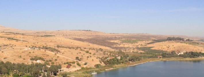
The ruins of several ancient cities lay one above the other on Kinrot hill, a natural ridge steeply sloping down on all sides except on its northern face that gradually rolls out into the gentle hills of Lower Galilee. Due to its strategic location on a small pass, Tel Kinrot controlled the Via Maris – the major trade route that has connected Egypt and Syria since the Early Bronze Age. In addition to its important position, favorable natural resources, such as perennial springs and the fertile plain of Ginnosar in the direct vicinity, made Tel Kinrot a highly attractive place for its inhabitants. The mound itself covers approximately 10 ha (25 acres), today about half of the area (exactly 5.55 ha/13.71 acres) are accessible for scientific research. A pumping station of the Israeli water company Mekorot occupies the other, southwestern part of the site .

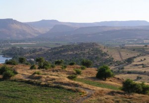
View on Tel Kinrot from North (Mount of Beatitudes), further to the left lays the Ginnosar Plain, the Cliffs of Arbel and – a bit to the right in the background – the Horns of Hattin (photographed by Merja Alanne; © Kinneret Regional Project).
Identification
Tel Kinrot / Tell el-‘Oreimeh was identified with the Biblical town of Kinneret by Gustaf Dalman in 1921 and William Foxwell Albright in 1923. The identification was based on the fact that Tel Kinrot/Tell el-‘Oreimeh is the only large and fortified archaeological site on the western shore of Lake Kinneret with Iron and Bronze Age remains. Although the toponym Kinneret (or Kinrot/Kinnerot) appears several times in the Bible, only a single attestation refers to a town, namely in the «list of fortified cities» in Joshua 19:35. In other passages, Kinneret designates the Lake (yam Kinneret in Num. 34:11; Deut. 3:17; Josh. 11:2; 12:3; 13:27) or a region (kol Kinnerot in 1Kgs. 15:20). Apart from the Bible, Kinneret is also mentioned in much older Egyptian sources: the list of Palestinian cities conquered by Thutmoses III (1490-1436 BCE) at Karnak and in Papyrus Petersburg 1116A, equally dated to the 18th dynasty .

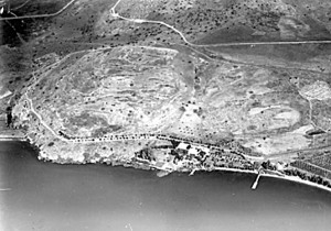
The mound of Tel Kinrot from the air, on the shore the old Pilgerhaus and mooring installation built by Gottlieb Schumacher (photograph ca. 1917; © Bayerisches Staatsarchiv).
History of Excavations
First explorations on Tel Kinrot were undertaken by Paul Karge in 1911 who mainly concentrated on prehistoric remains. First excavations were conducted by Robert Köppel in 1932 and 1939. Only few results were published. In the 1950s, Israeli archaeologists Gershon Edelstein and Bezalel Rabbani examined archaeological remains on the premises of the future Mekorot pumping station and on several spots on the foot of the hill . Further archaeological work was carried out in the 1980s by Shan M. M. Winn (University of Southern Mississippi) and Jak Yakar (University of Tel Aviv) who cut a small, but deep trench near the Lake shore, successfully searching for evidence of an Early Bronze Age occupation . It was Volkmar Fritz (University of Mainz/Giessen, Germany), however, who directed the first systematic and continuous excavations in several campaigns between 1982-1985 on the hill’s peak («Acropolis») from 1995-1999 and again in 2001 on the lower southeastern slope of the mound . Since 2002 «Kinneret Regional Project» – an international consortium of the Universities of Berne (Switzerland), Helsinki (Finland), Mainz (Germany) and Leiden (Netherlands) directed by Stefan Münger, Juha Pakkala and Jürgen Zangenberg – continues Volkmar Fritz’ work on Tel Kinrot and in the wider region around it .
Settlement History
In most attested phases of ancient occupation, habitation extended over the entire mound. Only in the Iron Age-II period (Strata I-III, excavated in 1982-1985) settlement seems to have been reduced to the Acropolis and the immediate vicinity, while remains encountered on the southeastern slope since 1994 date to several periods of the Iron Age-I («Early Iron Age Horizon« represented by Strata IV-VI) and the Bronze Ages (Strata IV-X). Some scattered remains from various periods postdating Stratum IV were exposed on the slope as well .

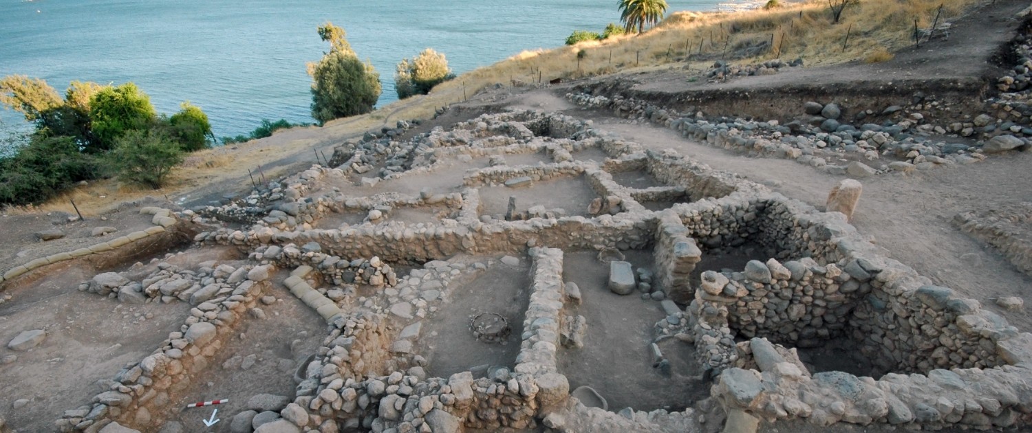
Trapezoidal building complex in Field I on Tel Kinrot, dating to the Iron Age I (photographed by S. Münger; © Kinneret Regional Project).